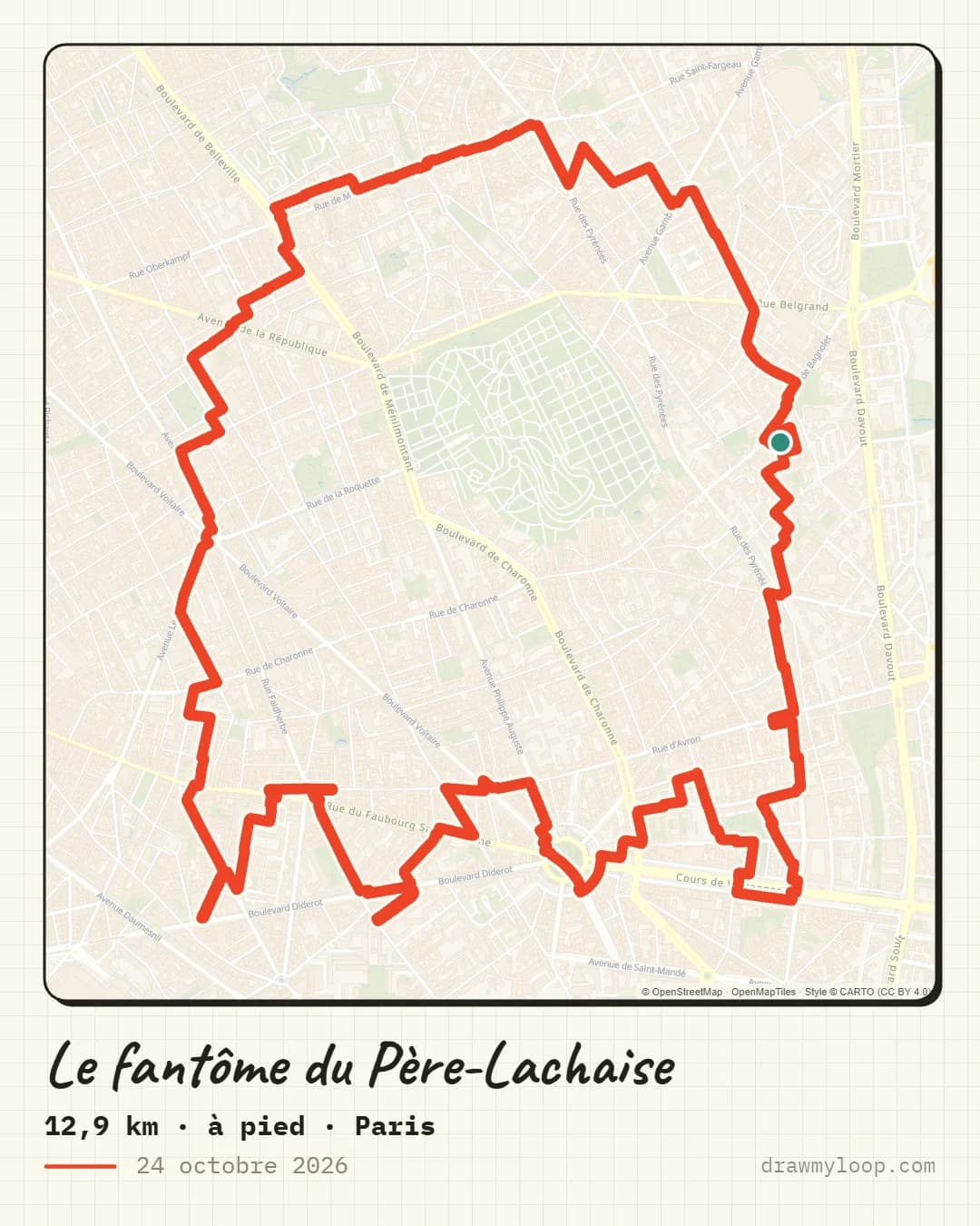
The Père-Lachaise ghost
The ghost circles Père-Lachaise cemetery in eastern Paris, with its points facing south.
On foot12.9 km
Download the GPX draw my loop
Six Halloween drawings traced on the streets of Paris, Lille, Lyon, Brest, Bordeaux and Toulouse, with a free GPX for each route.
For Halloween, we drew six shapes on the streets of six French cities: a ghost, a pumpkin, a witch's hat, a scythe, a skull and a bat. Each route can be done on foot or by bike, and the drawing appears on your Strava map at the end of the activity. The GPX files are free to download, no account needed.
Each image shows the real route on the map. The button downloads the GPX directly, no sign-up needed.
The ghost circles Père-Lachaise cemetery in eastern Paris, with its points facing south.
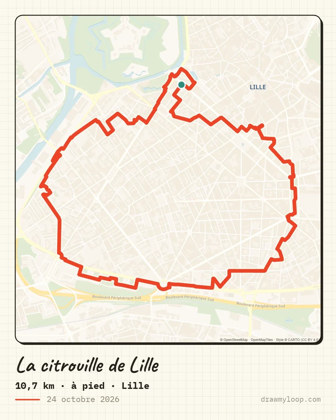
A round pumpkin in the heart of Lille, with its stem pointing to the Citadel.
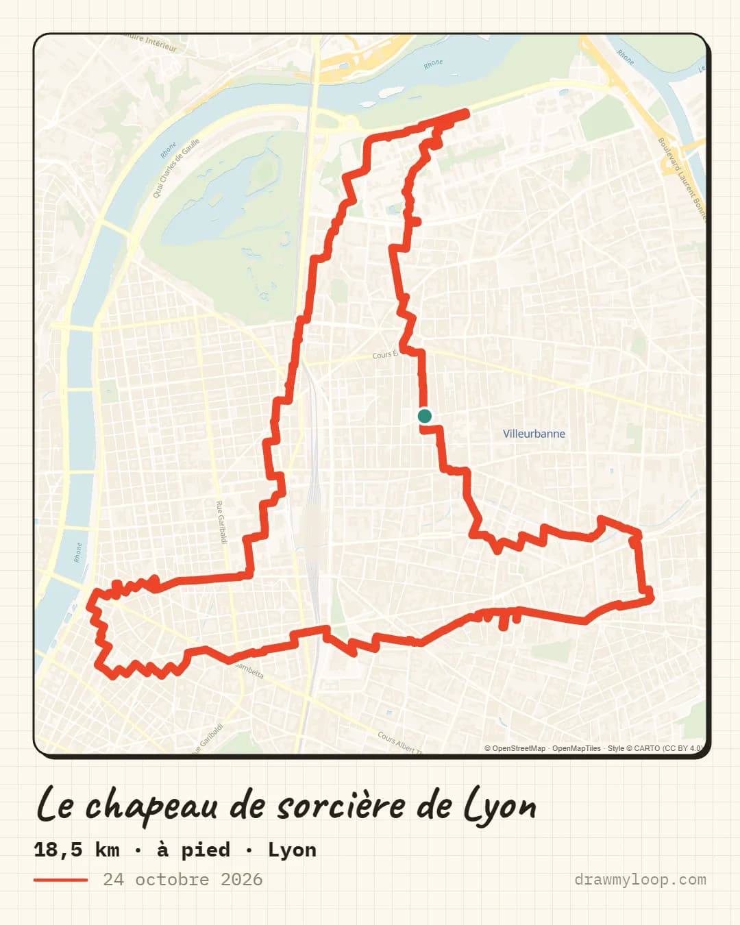
A tall pointed hat between the 6th arrondissement and Villeurbanne, with its wide brim to the south.
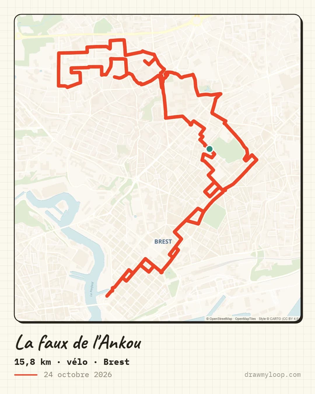
In Brittany, the Ankou is the figure of death and carries a scythe. Its blade runs north of Brest city centre.
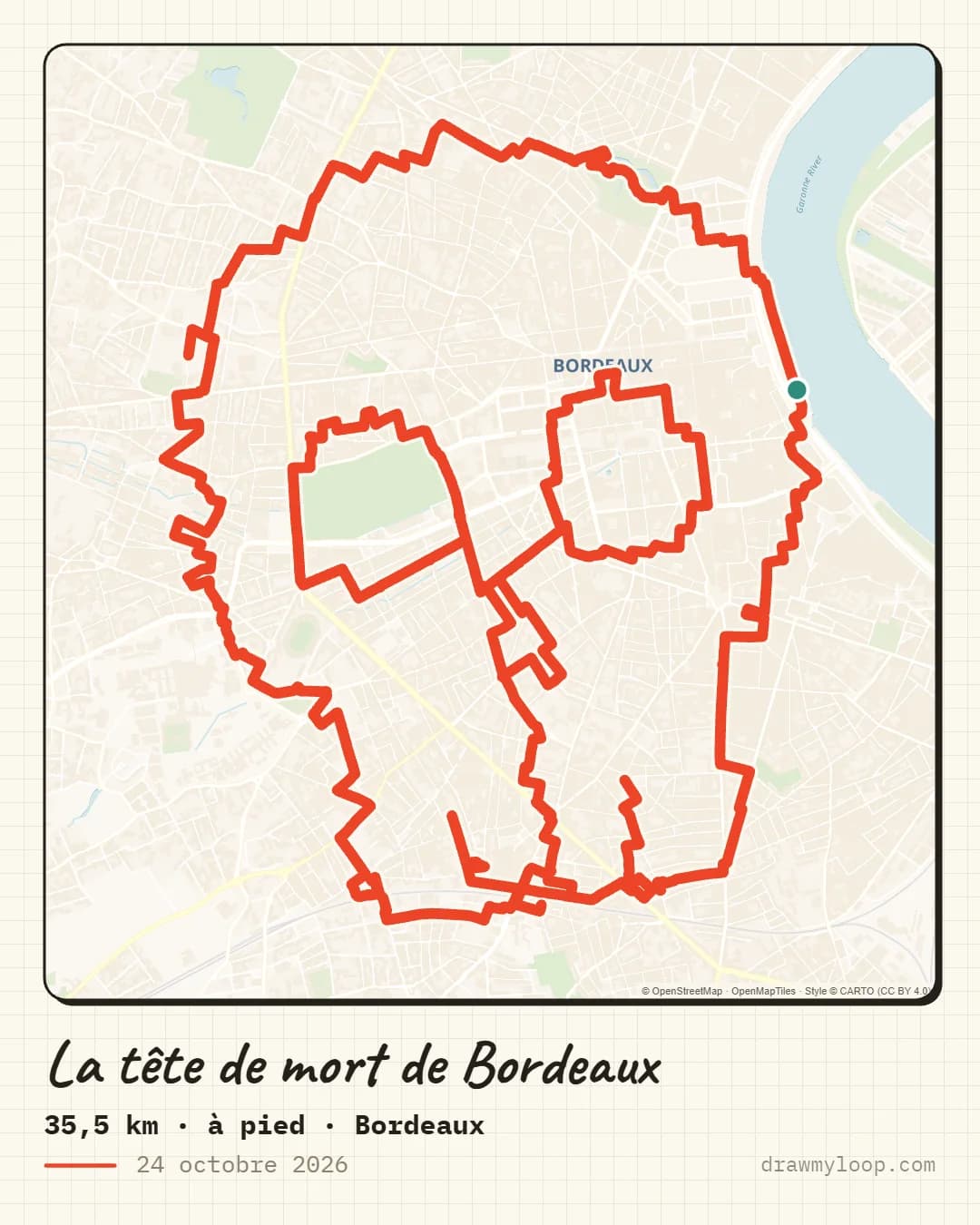
A skull covering central Bordeaux up to the Garonne quays. It is the longest of the six routes.
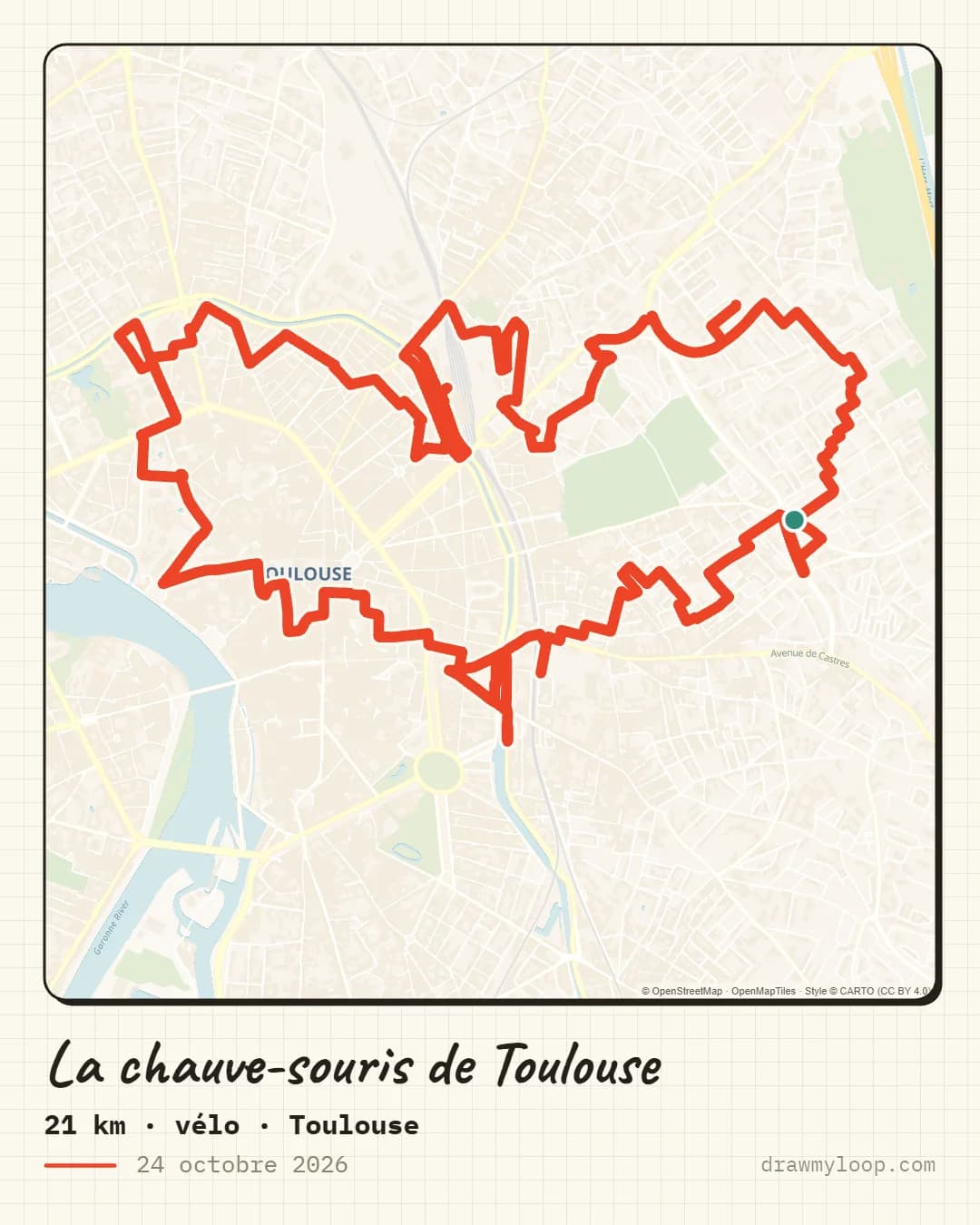
Routes checked on 24 October 2026: one-way streets, private roads and closed roads.
Each shape was placed on the city by Draw My Loop's Auto-Fit, which looks for the spot where the streets match the drawing best. Dense city centres work best: the more streets there are, the more readable the curves and points stay. That is why the routes go through central neighbourhoods, like the ghost that circles Père-Lachaise cemetery in Paris.
A drawing that looks good on a map is not enough, you also need to be able to follow it. Each route was checked section by section: no wrong-way streets on the bike routes, no private roads and no roads closed to pedestrians. Small useless out-and-backs were removed. Roadworks and temporary closures cannot be known in advance, so keep an eye on the ground on the day.
Download the route's GPX, then import it as a route in Strava, Garmin Connect or Komoot. Start navigation on your watch or phone from the green start point and follow the line. The drawing shows up once the activity is saved and synced. Our GPX export guide explains the import in each app.
Your city is not on the list? In the studio, pick a shape (the ghost, the moon and the cat are in the library), place it on your neighbourhood or let Auto-Fit find the best spot, then export the GPX. Shapes with a clear silhouette give the best results, on routes of 10 to 20 kilometres.
Custom service
Tell us your idea and your area, we prepare the route by hand. You get a preview within 48 h and only pay if you like it.